A city divided
Through donor and volunteer support, the U of M’s Mapping Prejudice project exposed housing as a force behind Minneapolis’ racial disparities—and led to change
As a third-generation Minneapolitan, Kirsten Delegard grew up in the 1970s believing her hometown was a model city—that it was progressive and a leader in the fight for social justice. But after going away to college, training as a professional historian, and living in Europe and throughout the United States, she came back and saw it from a different perspective.
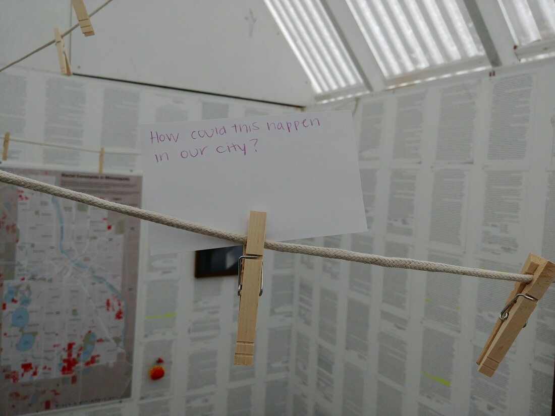
“I found myself confronting the fact that Minneapolis is a great place to be as a white person, and that it’s not a great place to be as a person of color,” she says. “Our racial disparities are, in many ways, the highest in the nation.”
Delegard wanted to use her research skills to find out why.
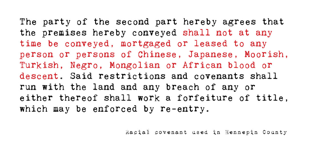
Her work researching the more troubling side of Minneapolis’ past for the Historyapolis project at Augsburg University often brought her to the University of Minnesota Libraries. As she sifted through documents in the archives and talked to people in the Jewish community and others, she kept hearing references to racially restrictive covenants—clauses in property deeds that make it illegal for a person who is not white to own or occupy a piece of land.
“But no one could tell me how many there were or what they said,” she says. “I became curious. Where were they? How did they get put in place? Who made decisions about where they went? How did they affect people’s lives?”
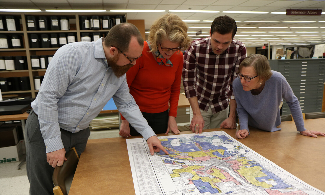
To find answers, Delegard partnered with Ryan Mattke, head of the University of Minnesota’s John R. Borchert Map Library; U of M graduate student and geographic information specialist Kevin Ehrman-Solberg; and researcher Penny Petersen to found Mapping Prejudice. Their goal: to search Minneapolis property deeds, build a database of those that contained racially restrictive covenants, and share what they learned with as many people as possible.
In 2016, they published the first-ever interactive map of a U.S. city showing how and where the use of racially restrictive covenants increased from 1910 to 1955.
Community comes together
Delegard, who now works for the University of Minnesota and runs Mapping Prejudice out of the Borchert Library, didn’t expect the attention the map brought once it became public. Team members have been interviewed by local, national, and even international media outlets and have spoken at conferences, U of M events, and neighborhood association meetings.
“I never anticipated the emotional reaction we got from people,” Delegard says. The first letter they received after the map was published was from a man who described how it altered his understanding of the community and made him want to work for change.
“The map has changed people’s lives,” she says. “That’s humbling.”
Volunteer power
Volunteers have been key to the Mapping Prejudice project. Since it began in 2016, more than 4,600 people have donated more than 21,000 hours reading through and recorded details from 318,000 pages of property records for Hennepin and Ramsey counties. Here’s how to get involved.
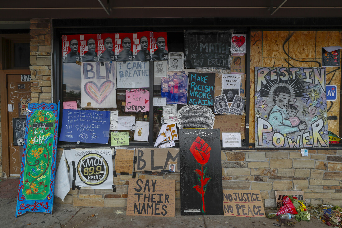
The publicity also brought volunteers and donors to the project. More than 4,600 people have contributed their time, including some 400 Medtronic employees who recently transcribed covenants from more than 5,200 property deeds into the database. After Minnesota’s stay-at-home order was issued in an effort to control COVID-19 and after the death of George Floyd in May, the number of volunteers grew exponentially. The transcription rate went from a couple of hundred documents a day to more than 5,000 a day.
Donors also have been critical to the project’s success. Although the University provided space and the library’s resources, it didn’t cover staffing or other expenses. “We were always running on a shoestring,” Delegard says. “We only exist today because donors from the community sought us out and gave us money at critical times. Without that start-up money, we wouldn’t be here.”
Righting wrongs
That support for Mapping Prejudice has led to change in Minneapolis and throughout Minnesota. City leaders used its findings to inform them when developing Minneapolis’ 2040 strategic plan. “Data we produced provided a missing link to explain how the city’s land-use policies contributed to enormous racial disparities,” Delegard says.
Starting in the mid-1920s, when the city adopted its first zoning code, it became much more difficult to build anything but single-family homes in Minneapolis’s residential areas. That changed in January 2020, when the city began allowing buildings with up to three units to be built on any property, the idea being to create more affordable housing.
In 2019, Governor Tim Walz signed legislation that lets Minnesota homeowners amend their property deeds in order to “discharge” racial covenants. In other words, property owners can add language to the record saying they don’t endorse racial restrictions included in their property title.
Delegard says they’ve had hundreds of inquiries from people wanting to know how they can discharge restrictions.
In addition, the team, which finished its work in Hennepin County, began building a map for St. Paul and Ramsey County in January 2020. “Our goal from the beginning was to map racial covenants for Hennepin County, but it was clear as we approached the finish line that the work had just begun,” says Delegard.
She has received inquiries about creating similar maps in Milwaukee; Washington, D.C.; Syracuse, New York; Rochester, New York; Madison, Wisconsin; and Orange County, California. Earlier this year, the Mapping Prejudice team received a $324,478 grant from the National Endowment for the Humanities that will allow them to make the digital tools available to any community that wants to build such a map. In October, the project received a Catalyst award from the National States Geographic Information Council.
“It’s clear that this is bigger than us,” Delegard says. “We would not be able to win that grant without the help provided by our initial angel community investors.”
Kim Kiser is editor of Legacy magazine.
What shaped Minneapolis
Before 1910, Minneapolis wasn’t particularly segregated. African American communities were being established near West River Road, around Lake Harriet, and on the east side of the city.
That started to change in 1909. Madison Jackson, an African American Pullman porter with a law degree, built a home in Prospect Park, an otherwise white neighborhood, prompting outrage on the part of white residents. When his friends William and Daisy Simpson started building nearby, a mob of more than 100 white people marched on the Jackson home, where the Simpsons were staying during the construction, to try to keep them from moving in.

In May 1910, the first racially restrictive covenants—clauses inserted in property deeds that make it illegal for a person who is not white to own or occupy a piece of land—were included in deeds in south Minneapolis. These covenants, which were upheld by the Supreme Court, established invisible racial boundaries within the city.
In 1934, the Federal Housing Administration was established, and with it, the Home Owners Loan Corporation (HOLC). The HOLC underwrote mortgages to take pressure off the banks, making it possible for working-class people to own homes. It also established a color-coded rating system for neighborhoods, connecting an area’s desirability to its racial composition.
Neighborhoods that were occupied predominantly by African Americans or other minorities were coded “red,” with applicants least likely to be approved for mortgages, regardless of their qualifications. “Green” neighborhoods, most of which had racial covenants in place, were considered the most desirable in terms of risk.
The combination of racial covenants and “redlining” often confined people of color to certain parts of the city and made it impossible for them to buy a home. Thus, they were unable to build wealth through homeownership to pass down to their children and grandchildren.
Although the federal Fair Housing Act of 1968 made it illegal to discriminate in terms of who can buy or rent a home, the effects of racially restrictive covenants and redlining are still felt today. Whereas 75 percent of Minneapolis’ white residents own their homes, only 25 percent of Black residents do—accounting for one of the largest racial gaps in homeownership in the United States.
Source: Jim Crow of the North